 [/caption]
Notikewin Provincial Park is a little-known gem-of-a-park along the Peace River. It spans the Notikewin River – originally named the Battle River after many Cree-Beaver Indian battles that took place in the 1700’s in this area.
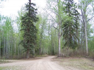
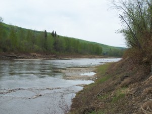
There’s a campground at the north end of the park, with 19 lovely sites nestled among the tall, old-growth balsam poplar and white spruce at the lower part of the bank along the Peace. This well-maintained campground provides fire pits, firewood, picnic tables, water and basic outhouses. There are two day-use areas, one of which has a walking trail which leads to a nice view from up high on the bank. A path at the far end of the campground leads directly to the Notikewin River.
 [/caption]
As with many river mouths, there’s good fishing to be had! Most common species caught are Goldeye, Northern Pike, Walleye, but you may also catch Arctic Grayling, Burbot, Finescale Dace, Flathead Chub, Longnose Sucker, Slimy Sculpin, White Sucker. There are also great rockhounding opportunities along the gravel bar at the mouth of the Notikewin. Many different fossils can be found, including the rare and beautiful ammolite. Ammolite comes from Ammonites, shelled creatures that lived 425 to 65.5 million years ago. So, the fossils have that subtly luminescent appearance of a shell or pearl, in spiral or conical shapes.
The park is a known habitat for deer, moose, elk, as well as bears, sandhill cranes, bald eagles and many other bird species.
Directions
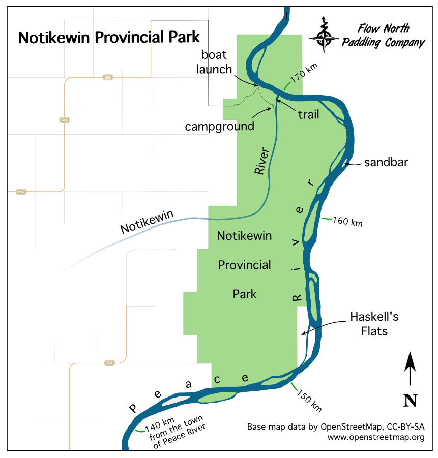
Coming from the direction of Manning, follow secondary hwy 692. The road eventually leads to a gravel road (shown in black on the map above) which gives access to the day use areas, campground, and boat launch. Drive with caution down the steep hill! [topo map via Open Street Maps]
Coming down the river (from the south; the current flows north), you’ll paddle by most of the park before getting to the actual campground. You’ll notice on the map that Haskell’s Flats (around 151-153 km mark) are not part of the park; this is agricultural land named after the landowner who originally settled here before the park was established, hence the land was excluded from the park. Paddle another 18 km or so and you can land your canoe/kayak just beyond the Notikewin River mouth and walk to the campground. If you follow the bank of the Notikewin River, upstream for about 400 m, you will reach a trailhead that leads to the campground (57.281838000 N 117.134809000 W). It’s quite a walk to the campsites — 800 m altogether (estimated). The forest trail leads through a patch of ostrich ferns — up to 2 m (6 feet) tall. It’s a magical place!
For less walking, paddle on to the boat launch and take your boat out there. Canoeists are allowed to camp overnight in the day-use area near the boat launch. There are some very old trapper’s cabins near the day use area. When the road was being constructed in this area, a huge bed of charcoal was discovered — the remains of fires built by Beaver Indians each summer to dry and smoke the fish they would catch in the Notikewin and Peace rivers. The Hudson’s Bay Company operated a fur trading fort from approximately 1866 until 1897 near here (east of the Notikewin river mouth).
Campsite reservations are not required for Notikewin Provincial Park. Camping costs $17/night, with $2/night discounts for seniors.
Where we paddle | Trip Details | In the North | Paddling Packages | Cruising Google Maps | Why Go Paddling | Day Trips
