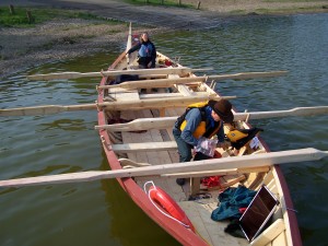
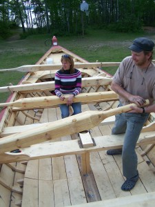
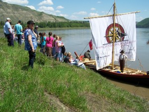
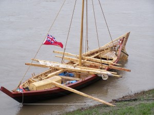
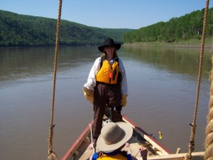
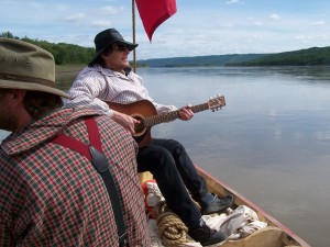
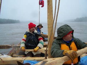
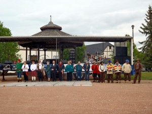
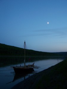
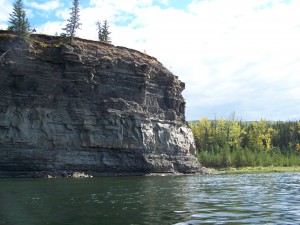
On Saturday, June 18th, my crew and I arrived safely in Fort Vermilion! There were a couple of hundred people there to greet us as we brought our boat to rest on that muddy shore. They’re all muddy shores it seems! 🙂 We left our campsite at Wieler’s Landing a little late, so we had to row pretty steadily for four hours to arrive on time. But hey, we’re hardened Yorkmen, so it wasn’t too tough!
The trip was absolutely amazing, and that was in large part due to the incredible crew I had! They had wonderful, positive attitudes, great senses of humour, strong initiative, keen work ethics, and were just the best damn crew a Captain could want! I have never before experienced teamwork like that, and I consider every member of the crew a member of my family now.
It wasn’t easy saying goodbye, but at least 2 of them live close by and we’ll visit often. I’ll be blogging lots more about the trip, and you’ll also be able to read about it in some magazine articles in the coming months.
NEW! York Boat Photo of the Day!
I’ve decided to share some of my photos with you, releasing one each day. Some are of the boat, some of the crew. Click for larger view. Enjoy!
Since Teresa is still on the water, I, Darren, am posting some of the latest pictures and information from the York Boat Expedition. The crew left Dunvegan, Alberta on June 1st, and they’re all set to arrive at Fort Vermilion on June 18th.
They’re having a fantastic time, being welcomed by communities and school groups all along their journey. The hospitality they’ve received has been wonderful.
You can read all about the York Boat expedition at the Geotourism Canada website, including scheduled stops.
There’s also a live progress map, a Facebook page, and a Twitter page.
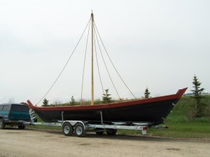
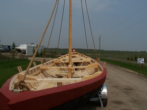
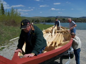
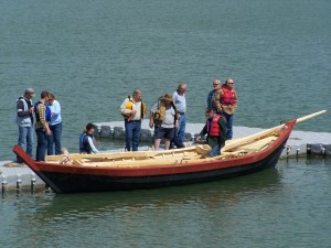
Well, the York boat is on the road! The construction is complete, and we left the build site today. We just wanted to quickly update you and show you a few photos of the York boat going onto the trailer and the lake test at Ghost Reservoir! Enjoy!
Come see us at the grand opening/launch/big push off at Dunvegan Provincial Park on June 1!
Read more about the York boat here. Click for larger photo.
Hello everyone! We’ve been working really hard, along with GeoTourism Canada and North Woods Canoe, to get ready for the York boat expedition! Just wanted to quickly update you on how it’s been going.
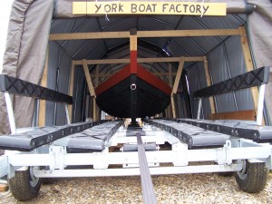
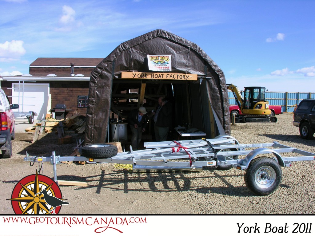
Teresa arrived at the “York Boat Factory” a little over a week ago, to have her first look at the boat. It was awesome! It was great to actually see it — she had been trying to picture the sheer size of it, but once she saw it, it wasn’t actually as overwhelming as she thought it would be. Over the next several days, she helped with a few small finishing tasks on the boat, which was a very neat opportunity. Unfortunately, we can’t upload any photos at this time, but GeoTourism Canada has lots of photos here.
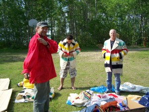
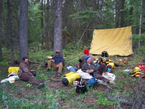
The rest of the trip planning has been going well. An emergency plan is in place, as well as a meal plan. The crew will be feasting on dried moose meat, potatoes, carrots, turnips, oatmeal for breakfast, and “cracklings.” This is a fatty food, essentially just ground pork. It should be interesting! We will sleep with wool blankets, and wear our Yorkmen/voyageur costumes while we row and jackets made from Hudson’s Bay blankets in the evenings.
One reason for this update is to let you know that we have an opening on the crew! One of the men had to cancel (he has very good reasons we won’t disclose here, and he was very disappointed he can’t come). So, if you are interested, please fill in the form here as soon as possible! We start training this week, which, ideally, you can come for, but even if you can’t make it for all the training, or the whole trip, please apply. We know, it’s quite a long trip — June 1 to 18 — but if you can do half or so, please let us know! We can even accomodate 2 more people, if there’s a couple out there that would like to join us, or you’ve got a friend who would be keen!
We’ll try to update you more after we do the first lake trials this week! Stay tuned…
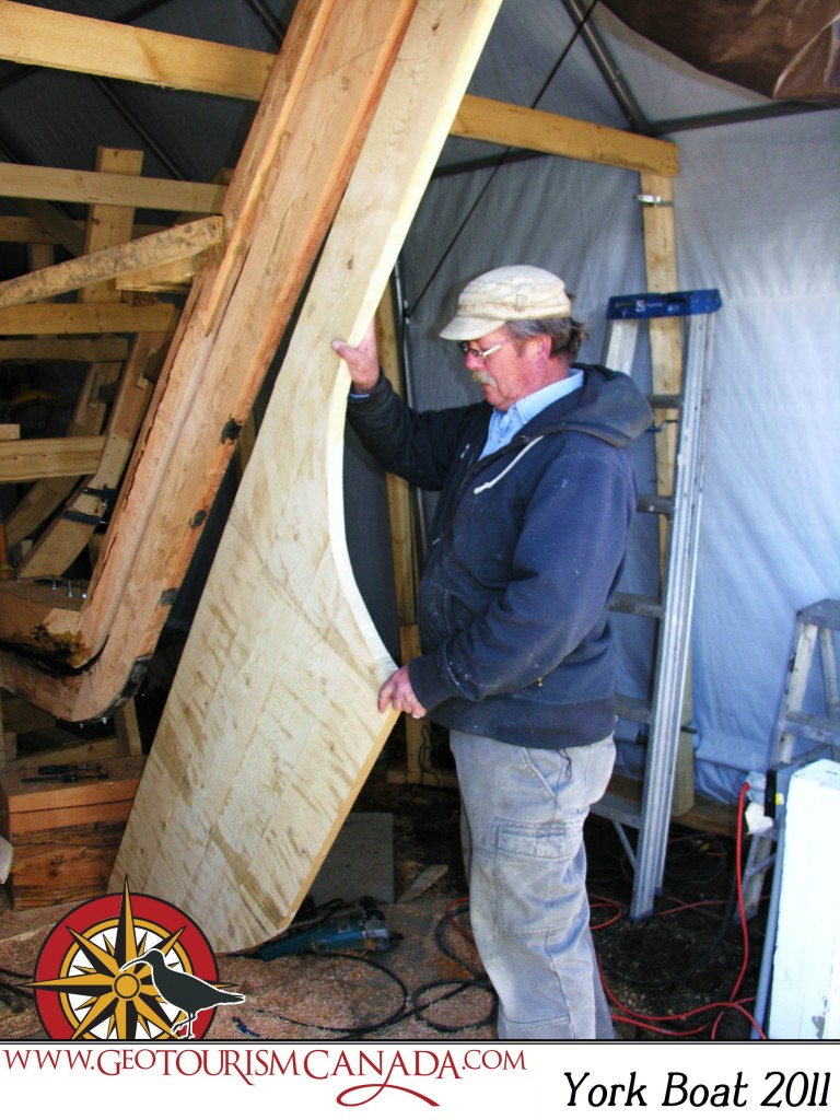
The York Boat project is coming along nicely, with lots of the details that need to be taken care of coming together. One of the project members recently visited the construction site at North Woods Canoe and send these pictures along. Check out the GeoTourism Canada Facebook page for updates too!
We still have a couple of spots available for the crew! Please see this page for more info and to sign up (link is at the bottom).
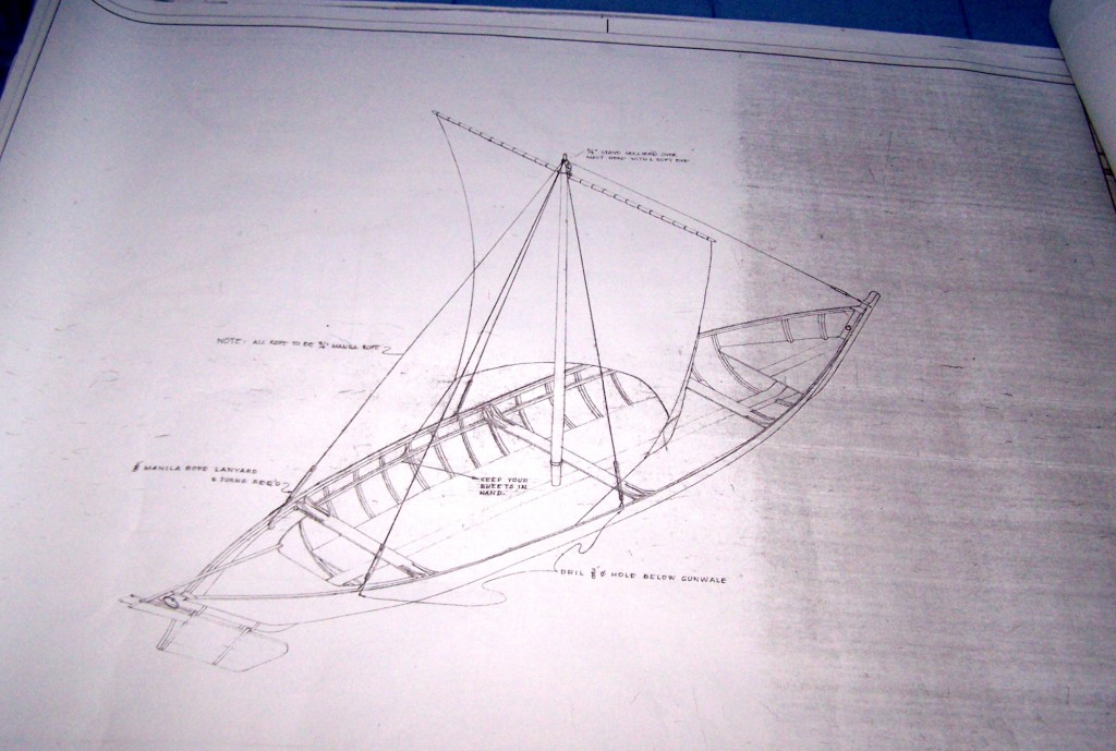
It’s official! Flow North Paddling Company is working with GeoTourism Canada to manage their York Boat Project. We have obtained copies of York boat plans created in the 1970’s from the last surviving boats. We received three quotes for York Boats and settled on Northwoods Canoe Company of Cochrane, AB, to build the boat. They have begun construction and anticipate completion in mid-May. This puts us on track for an expedition from Fort Dunvegan to Fort Vermilion — 538 km — to start around June 1.
York boats were used in the latter part of the fur trade. The Hudson’s Bay Company started building wooden boats of varying design when they began moving to inland posts, primarily due to competition from the Northwest Company. At the peak of their use, more than 200 York boats were used at once on rivers and lakes across Canada. Indeed, some say that Canada may not have become a country without the York boat. Their use allowed for more efficient transportation of furs and trade goods and helped establish a key settlement at the forks of the Red and Assiniboine Rivers (Red River Settlement, now Winnipeg). As few as five of the large York boats (13 metres long) could haul as much freight as a shipping container.
Flow North is coordinating the crew selection process. Apply using this online form, hosted on GeoTourism Canada’s website. Crew members will be selected based on:
– strength and endurance
– mental toughness
– ability to work with a team
– willingness to live as a yorkman for the duration of the trip.
Interested people must complete their application by April 4. Those who are shortlisted will be contacted to perform physical tests. People wanting to participate should have May 24 – June 18 available.
Facts about our York boat
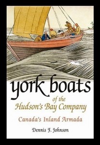
York Boats of the Hudson’s Bay Company by Dennis F. Johnson is an excellent book about York boats.
| We’ve mentioned before that Flow North has been working with GeoTourism Canada to create a guide for the Peace River, and it’s almost complete! It will be available on GeoTourism Canada’s Go Vado! website in a couple of months, but we thought we’d give you a sneak peak.
We’ve written this guide to the Peace River to be both interesting and practical. From a practical standpoint, we’ve listed possible campsites and emergency road access, and 119 GPS waypoints for major stopping points, like boat launches, camping or rockhounding sites. Some major gravel bars and shallow areas are mentioned, but of course, the river is always changing and with river levels fluctuating because of the dam, it’s very hard to predict what areas will be problematic and what areas you’ll just float right over. Besides the practical stuff, we’ve also researched the history of the river, its landings and settlements, and included plenty of stories and geology. We know you will find this guide interesting and extremely useful! To help you plan your trip, have a look at the overview below, read this page about trip planning, and then call us to reserve your boat! The last column of the table below indicates distance paddled if you start in the town of Peace River instead of Hudson’s Hope. Of course, there are many places along the river that you can start from — contact us if you want more info — and you can calculate intermediate distances from the running totals. Guide #1 is about things to do in Hudson’s Hope, the starting point, and the paddling journey starts with Guide #2. |
| Guide # | Starts at | Ends at | Places along the way | Road access at the starting point? | km paddled | km from Hudson’s Hope | km from Peace River |
| 1 | Hudson’s Hope | Hudson’s Hope | W.A.C Bennett dam, Peace Canyon Dam | yes | 0 | 0 | |
| 2 | Hudson’s Hope | Halfway River | Lynx Creek, Gates, Farrell Creek | yes | 38 | 38 | |
| 3 | Halfway River | Island’s End | Bear Flat, Waterfall, Cache Creek | yes | 32 | 70 | |
| 4 | Island’s End | 101-km Campsite | Site C dam, Old Fort St. John, Taylor, 3 bridges | no | 31 | 101 | |
| 5 | 101-km Campsite | Driftwood Campsite | Beatton River, Raspberry Island, PR Corridor Prov. Park | no | 32 | 133 | |
| 6 | Driftwood Campsite | Cotillion Rec Area | Clayhurst Bridge, Pouce Coupe River, Clear River | no | 32 | 165 | |
| 7 | Cotillion Rec Area | Many Islands Park | Beverly (Deadman’s) Island | yes | 40 | 205 | |
| 8 | Many Islands Park | Pratt’s Landing | Montagneuse River, Carter Camp | yes | 41 | 246 | |
| 9 | Pratt’s Landing | Fort Dunvegan | Ksituan River, Dunvegan Suspension Bridge | yes | 28 | 274 | |
| 10 | Fort Dunvegan | Camp Island | Green Island, Long Island | yes | 42 | 316 | |
| 11 | Camp Island | Tangent Park | Kieyho Park, Peace Valley Guest Ranch | yes | 36 | 352 | |
| 12 | Tangent Park | Town of Peace River | Mackenzie Cairn, Strong Creek Park, several historic sites | yes | 24 | 376 | 0 |
| 13 | Town of Peace River | Graham’s Flat | Rail, highway and DMI bridge | yes | 32 | 408 | 32 |
| 14 | Graham’s Flat | Peace Island | Encampment Island, 30-mile well | no | 25 | 433 | 57 |
| 15 | Peace Island | Sunny Valley | Whitemud River, Cadotte River | yes* | 34 | 467 | 91 |
| 16 | Sunny Valley | McCracken’s Flat | Kulyna’s Flats | yes | 38 | 505 | 129 |
| 17 | McCracken’s Flat | Notikewin Provincial Park | Horseshoe Bend | yes | 42 | 547 | 171 |
| 18 | Notikewin Provincial Park | Beaver Campsite | pipeline crossing, nice beach | yes | 33 | 580 | 204 |
| 19 | Beaver Campsite | Cigar Island | Big Bend | no | 32 | 612 | 236 |
| 20 | Cigar Island | Old Carcajou | Howard’s Landing, Carcajou, Wolverine River | no | 33 | 645 | 269 |
| 21 | Old Carcajou | La Crete Ferry Campground | Armstrong Flat, Buffalo River, Keg River | yes* | 31 | 676 | 300 |
| 22 | La Crete Ferry Campground | Horse Point | Le Fleur’s Post, rockhounding, Horse Island | yes | 32 | 708 | 332 |
| 23 | Horse Point | Aspin House Area | Moose Island, La Crete Landing, Etna’s Landing | no | 36 | 744 | 368 |
| 24 | Aspin House Area | Wieler’s Landing | Hungry Bend, Gooseneck Point, Prairie Point | no | 40 | 784 | 408 |
| 25 | Wieler’s Landing | Fort Vermilion | Big Island, Lawrence Island, Highway bridge, Buttertown | yes | 28 | 812 | 436 |
yes* = Road access is not exactly at the starting point, but is there is access nearby (explained in detail in the guide).
Don’t forget to fill in our “Perfect Paddling Trip” Survey!
Even though it’s fluctuating between -20 and -30 C, we’re still thinking of paddling! We’re in the works planning some themed trips, which we’ll announce soon, and we’re also performing a survey to see what people like best in a paddling trip! We’re looking for as much feedback as possible, so please visit the link below to do the survey!
