Some daily information and links with current conditions.
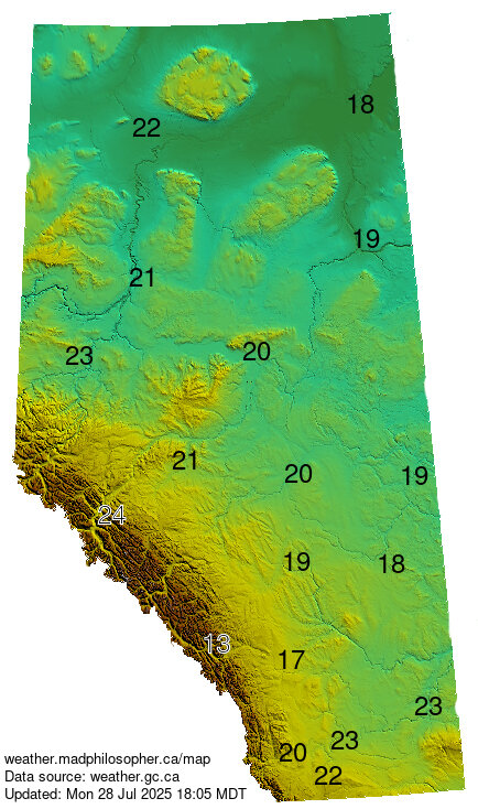
Current Alberta Temperatures
Today’s Fire Danger Rating
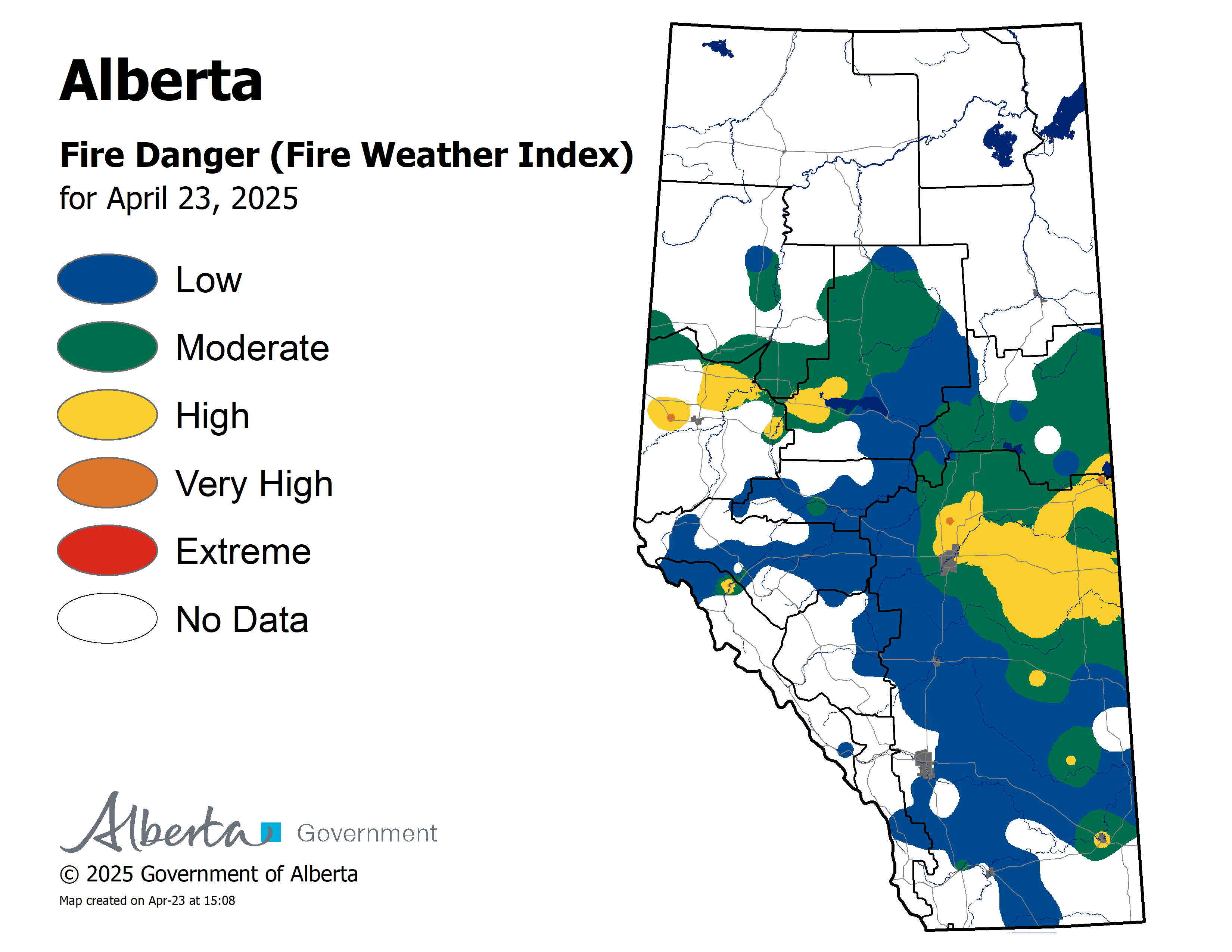
from the Fire Danger Forecast Page.
Alberta Wildfire Status Map
Fire Bans
Go here to check for Fire Bans. You will be paddling in the Northwest (top-left) corner of the province — you can see the Peace River on the map (use this to get your bearings); please call us if you have any questions about whether there are fire bans in effect where you will be paddling. Click here for the Northwest Territories.
Weather

Environment Canada radar (Prairies)
Cloud Cover

(The Peace River is marked in the image above.)
Graphical Area Forecast (shows warm/cold fronts, high/low pressure areas, etc)
Weather Forecast for High Level
River Levels
Peace/Slave River basin info (from Alberta gov’t)
Hay River basin info


Clear Sky Clock (a 2-day prediction of whether the sun will shine/stars will be visible)
High Level Area
Fort Vermilion Area
North Star/Sunny Valley Area
Peace River Area
Today’s K-P Index (indicates the probability of seeing any northern lights)

North Pole Auroral Activity
Red indicates most intense activity, yellow less so.
